The City of Little Rock has used ESRI’s WebAppBuilder to develop the mapping applications that you are using. The WebAppBuilder allows Little Rock’s GIS team to develop simple to use and mobile compatible applications for users to access data in regards to the City.
This guide is to assist users with instruction on how to use the applications and the tools (widgets) that are used with each application.
Contents
Title Bar and Data Date Information
Coordinate Display and Scale Bar
Splash Screen
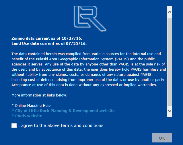
The first screen on any of the applications will be the splash screen which will contain the following:
· Date of the data that is the focus of the Application
· Disclaimer
· Links to other information including this help Document
· Check box acknowledging reading the information above (this check box will need to be clicked prior to continuing)
Screen Layout
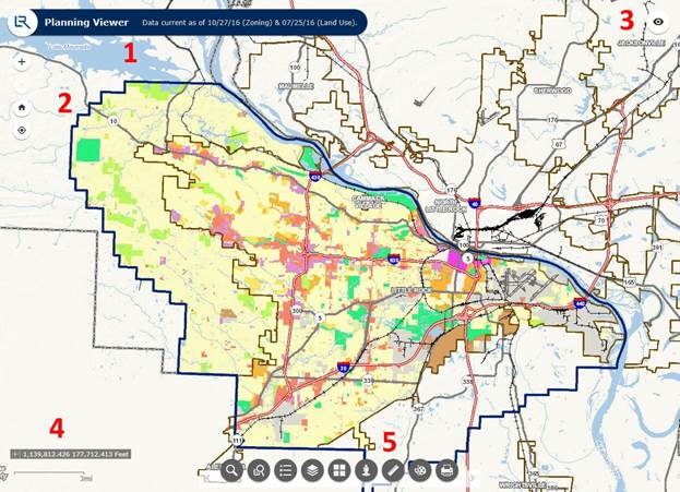
1. Title Bar and Data Date Information
2. Zoom and Track
3. Overview
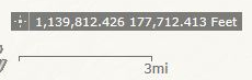
4. Coordinate Display (State Plane Arkansas North) and Scale Bar
5. Tool Bar (Widgets)
6. Information and Help
Title Bar and Data Date Information

This contains the Title for the Application as well as information as far as the vintage of the information that is the focus of the Applications
Zoom and Track
![]()
This contains controls to Zoom In, Zoom Out, Return to Home (Starting) View, Track Location (for devices with location functions)
Overview

This control opens to display an overview of the area around the current view in the screen
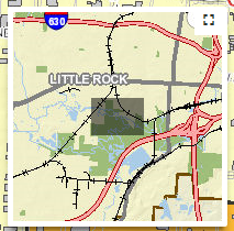
This allows the user to drag and drop the shaded box in order to pan. Click on the upper right part of the overview window to expand the overview. To close the overview click again on the overview button.
Coordinate Display and Scale Bar
Tool Bar (Widgets)

This bar at the middle of the screen contains various tools for each application.
Information and Help

This button accesses a link to Help documents as well as any other information that may need to be published for an application.
Tool Bar (Widgets)
The tool bar contains widgets which may vary from the different Applications developed by the City of Little Rock.

1. Address Search
2. Search Zoning Case Files
3. Legend
4. Layer List
5. Basemap Gallery
6. Google® Street View
7. Measurement
8. Draw
9. Print
Address Search
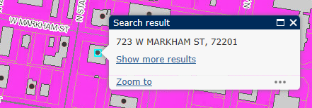
Click on the Address Search Icon.
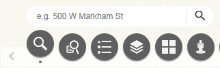
Type in the address and click the search button.
![]()
A choice of address matches are shown
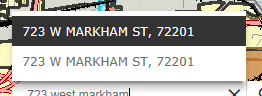
When highlighted an information bubble will appear for the selection displaying the location.
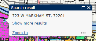
Click Zoom to in order to zoom to the location.
Search Zoning Case Files
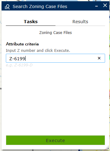
Click on the Search Zoning Case Files Icon.
![]()
Type in the Zoning Case Number in the window that opens and click the Execute button.
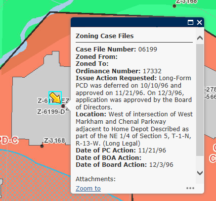
A match is shown
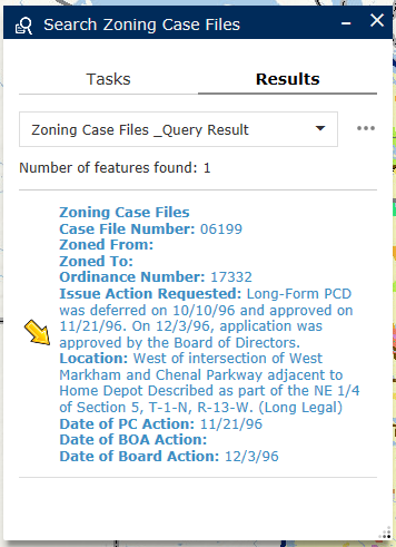
Click on the yellow arrow to zoom to the location.
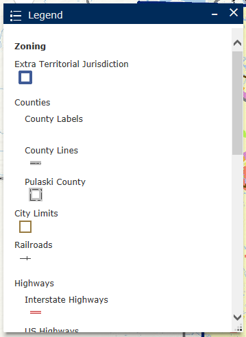
Legend
Click on the Legend Icon.
![]()
A new window opens with the legend for the objects on the screen.
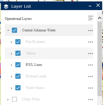
Layer List
Click on the Layer List Icon.
![]()
A new window opens with the List of Layers available in the application.
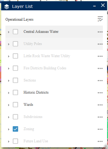
To see a layer not shown, check the box next to that layer.
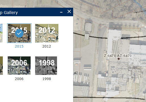
Basemap Gallery
Click on the Basemap Gallery Icon.
![]()
A new window opens with the Basemaps available for the application.
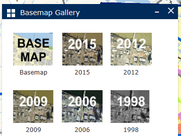
Select a Basemap to change the background.
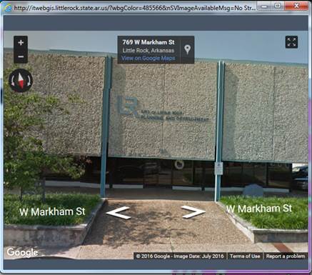
Google® Street View
Click on the Click the Google Street View Icon.
![]()
Select the Street View “man” from the window that opens and drag over to the location desired.
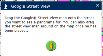
A new window opens with the street view if available.
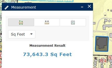
Measurement
Click on the Click the Measurement Icon.
![]()
A new window opens with the 3 measurement tools available: Area, Length, & Coordinate.
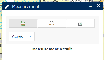
Select the tool, then select the unit of measure in the pull down, then click on the map to set the corners of the shape. Double click when the area or length is completed.
Draw
Click on the Click the Draw Icon.
![]()
The Draw window opens.
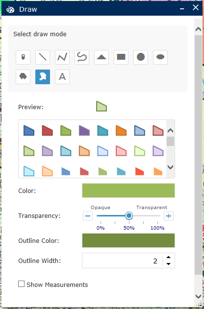
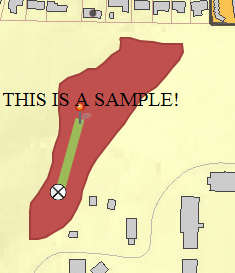
Several different draw modes are available to make temporary objects and text on the screen.
Click on the Click the Measurement Icon.
![]()
Click on the Print button in the window that opens.

After a few seconds a pdf will appear. Click to open the pdf and print to your local printer.